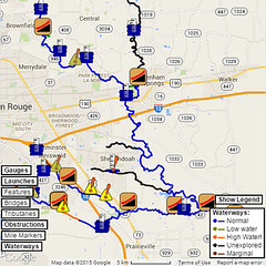
Ward Creek — Recon One
Jonathan Scott had expressed interest in doing a complete recon run of Ward Creek in order to see what was condition it was and what was out there. Well, I was academically interested as well, and as far as I knew, we would start somewhere around Bluebonnet Boulevard, plus or minus. After all, it was supposed to be a paddled recon run, wasn’t it?
Turns out he had other ideas. He wanted to see the whole thing, all the way to Bayou Manchac, but starting all the way up at what I call the Ward Concreek. Considering winter’s Project Flowing Fountain, I suppose I can’t exactly claim to be one to shy away from a challenge, so hey, why not? I suggested we start right around Webb Park (as I work right near there and already knew an access point — not a convenient one, mind you, but a possible one).
We dropped into Ward Concreek just after 9:00am. He immediately pulled out his camera and started snapping documentary photos. (I tend to document by coordinates and GPS waypoint notes, but I’m planning more visuals.) Anyway, after a few minutes we were off. Of course, by “off”, I mean we were walking along the bottom of the concreek with our pair of small kayaks floating/dragging along behind us. By a quarter mile or so downstream of College Drive, however, we finally hit the end of the concreek and found water deep enough (at times) to float the kayaks. We were off!
All along the banks, the trees were veritably covered in shreds of plastic grocery bags. It would be something to behold if it were not for the fact that it was actually a thorough coating of refuse. There was quite a bit of flotsam and jetsam around, and the creek bed had considerable amounts of rubble obstructing it at many locations along the way. Then about 0.7 miles in, we came to a nice little cascading waterfall. (Enough concrete and brick rubble was piled up, it made a small reservoir and accompanying waterfall a couple feet tall.)
Just beyond that was the first derelict bridge at about N 30° 25.809′ W 091° 07.721′. Paddling down Ward Creek in high water conditions might not be a bad run except for a few little details. This derelict bridge is one. The creek takes a right hairpin to get around a large quantity of logs, limbs, and even full downed trees that have been stacked against the remaining wood bridge pilings. In fast flowing high water, this would be an extremely dangerous strainer.
As we neared Corporate Boulevard, we were treated to a duck flying low across and along the creek right in front of us. A hawk was in hot pursuit right on its tail (with a second hawk flying along behind waiting its turn). It was an amazing sight that made the recon run worth its trouble, and we were still talking about it as we got out of the kayaks to work through the rocks and rip-rap at the Corporate bridge. Unfortunately, less than half a mile from the duck incident, the entire trek was about to take a considerable turn for the worse.
You see (or rather, you wouldn’t without being there), just behind and to the I-10 side of the Citiplace theater, there is a nice sewer manhole. It stands several feet above Ward Creek, but it is still within the slope of the bank. And as we neared it, it was *plainly* apparent that something was *not* right with the world. There, coming from the manhole cover, was a foul-smelling and clearly contaminated fountain of raw, untreated sewage. I need not say what a fantastic olfactory assault that presented, and *everything* in the creek from that point downstream for at *least* half a mile or more was completely covered in this fuzzy material — yeah, toilet paper fibers. *Utterly* revolting.
Well, after trying not to breathe much and being very careful not to drip any of the disgusting soup into the kayaks, we eventually made it the two miles to Essen Lane. There we found the bridge was completely blockaded with a near-forest of downed woody debris. There was no way through on water, and I’d hate to see what that does to drainage, but fortunately there was plenty of room under the bridge to portage. We carried the kayaks to the other side, and there we saw the “red water” being dumped into Ward Creek by some broken system at a local car wash. (Sadly, I was told that the soap would not actually make the raw sewage from two miles upstream suddenly go away, but at least most of the odor had abated by then.)
Then, less than half a mile later, the creek disappeared.
After the logjam that is Essen, Ward Creek is actually paddle-worthy for about a quarter mile. Then it becomes a small ditch with sharp banks barely wide enough to hold a kayak. I was in the lead, sitting in my kayak with my head virtually at ground level, and all of the sudden, I ran out of water completely. Someone has installed a small culvert right there in what little creek there is. There’s a section of what should be creek perhaps 25 feet or so long that simply doesn’t exist unless you’re a small snake or something of that ilk. There’s not much water on the other side, either, so the next quarter mile or so continues to be more of a narrow ditch in the middle of a field. Eventually you hit the treeline on the edge of the field, and a couple hundred yards or so later, the north fork of Ward Creek joins up, making the paddling much more possible.
Once the north fork joins up, you’ve reached the part where Ward Creek becomes Ward Drainageway. The banks have been cut into something resembling Ward Concreek, if not quite as barren. By the time you hit Bluebonnet Boulevard, finding enough water to float your boat is no longer an issue. While the area is not at all natural anymore, the grade separation between you paddling on the water and the cars high above makes for an enjoyable enough run. The complete and total lack of shade is unfortunate, however.
Half a mile downstream of the Mall of Louisiana Boulevard bridge, Ward Creek enters a section I call Ward Lake. The three quarters of a mile or so from there to Siegen Lane is wide, open, and fairly deep. Considering the meager non-flood flow of Ward Creek, there is no discernible current whatsoever in Ward Lake. The breeze across the water can actually feel fairly comfortable, on the other hand.
The section Ward Creek downstream of Siegen and along South Mall Drive is “Three Harbors”, so named because three large storm drains have eroded small “harbors” (easily visible on aerial maps), which are quite handy for easy canoe and kayak access. Just downstream of the bridge is South Harbor on the south/west bank of Ward Creek. I have not attempted to use South Harbor, as it is in a construction area and across active railroad tracks. On the north/east bank are the other two harbors. West Harbor is just across from the southeast corner of Lowe’s, and East Harbor is just before the road curves and passes in front of the nearby apartments. The worst thing about launching from East Harbor is carrying all the gear back up the hill afterward.
Continuing downstream from East Harbor, Ward Creek enters a fairly shady area. There is *plentiful* litter strained out on each bank whenever there is high water. A cleanup here would be well-advised, and most of it would be walking on the flat plateau of the banks (which would be convenient for a group cleanup).
Eventually the banks come in and form more of a V shape again, and shortly thereafter is Pecue Lane. The bridge was completely blockaded, but not nearly as badly as Essen. With the water slightly high, it was possible to slide along the bank side, but with the water lower, it would be a portage to be sure. The I-10 bridge that follows soon after was completely unimpeded (and currently under construction), but it does not appear likely to become a navigational difficulty.
The same cannot be said of the second (and last) derelict bridge along the run. I had previously noted it on aerial photos (just downstream of the end of Buzbee Drive), and I knew it was going to pose an issue. Sure enough, about three quarters of a mile downstream of I-10, there it was in all its woody glory. The tree debris (and whole trees, even) is piled up against it within feet of what remains of the road deck. Jonathan portaged around it, but as the water was high enough, I actually climbed my kayak over the lowest spot I could find and slid over. (It was exciting, and I *just* managed not to dump myself.) The bridge is a full-on obstruction to paddling navigation.
Fortunately, it was the last obstruction to navigation we encountered along the run. Barringer Foreman Road is unobstructed, and Highland Road was recently rebuilt and no longer has any impairments. The amount of litter floating around was also significantly lower than I’d expected, possibly because it had been washed out, or possibly because much of it had been strained upstream. There’s no good way to know the litter flow rate without first having a cleanup to establish a baseline from which it can be measured.
Ward Creek — Recon One statistics:
- Distance paddled, dragged, or carried: 15.4 miles
- Elapsed time: 10 hours, 46 minutes
- Overflowing sewers: 1 (and one too many at that)
- Blockaded bridges: 3 (two on the fully-navigable portion)