A Launch For All Levels

We spent Saturday at The Backpacker talking to lots of people about PaddleBR and BREC’s brand new and almost finished paddle launch, but with 3.7 inches of rain Monday morning, we figured we’d show off the capabilities of the new launch.
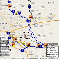
When we haven’t had recent rain, Bayou Fountain can get rather low. The USGS gauge at Bluebonnet bottoms out just below 3.6 feet. Anything below that is bad data. We usually measure by “feet of air under Rackley Bridge” at that point, and the lowest we’ve ever seen is right at seven feet clear (which would be approximately 1.3 feet on the Bluebonnet gauge.

This under-construction pair of photos from March 19th shows the launch a “normal” low-water level. I would estimate that we were between getting close to six feet clear at Rackley Bridge, so it could get just a tad lower at the extreme end, but not often and not by too much.

If you’ve had any decent rain in the week before you hit the bayou, you have a decent chance of being “on the gauge”, i.e. at least 3.6 feet as measured at Bluebonnet. We wanted to get a fresh progress photo for our table last weekend, so we dropped by on Friday after work.

The Bluebonnet gauge was reading right at 6 feet when this pair of photos was taken. As you can see, there’s plenty of water, but the current wasn’t bad. Generally, the current is high right after a rain, but then it tapers off after a day or two. If you’re on-gauge, it’ll still be a little more than the low-and-slow normal, but it’s not unpleasantly fast. If we could choose any water level, this would be our favorite.

And then Sunday night 3.7 inches of rain fell between the stroke of midnight and leaving for work in the morning. That’s enough to really bump up the level, so naturally, I had to rush off after work to get one more set of photos to show the launch at quite high water.

The Bluebonnet gauge was reading 10 feet when I got these photos. The bottom of Rackley Bridge corresponds to approximately 8.3 feet as a rule of thumb, and at 11 feet, water will be passing over it. So, this is a water level that we don’t see too often, perhaps only a handful of times a year (for various hand capacities).

From the looks of things, the Highland Road Park paddle launch should be perfectly usable for anyone who wants to take a high-water trip (which is quite easier downstream than up). We’d say call the nominal high-water limit of the launch at 11 feet on the Bluebonnet gauge. After that, you can pretty much just take a short walk from the parking lot and launch from the flooded ball fields.

Well, there you have it. The launch is unbelievably close to completion, and as you can see, it should be fantastic for just about any water level Bayou Fountain throws at it. (Note: This is not an invitation for another Great Flood or an epic drought!) We saw a little collection of debris at Rackley Bridge in our Monday survey, so we’ll be out checking on the bayou Saturday, but first, it’s another Sunset Paddle with BREC Outdoor Adventure on Friday. Should be fun (and no thunderstorm this time… please).