Touring Bayou Fountain
Touring Bayou Fountain

The bayou had been getting low again before the torrential rains brought high water and currents back just in time for a bayou tour. Well, at least the rain stopped.
For some time now, we’ve been trying to work out the logistics of giving a tour to various people from BREC. We wanted to show them Bayou Fountain as it now is, i.e. a wonderful signed paddle trail ready for (and already being used for) recreation. We know everyone would love it if we could get a better launch in place to remove the obstacle that is the steep bank, and frankly, we just wanted to show off all our hard work.
The bayou had been dropping for a while again, and it looked like it was going to be toward the low end (but still on the Bluebonnet gauge) come Friday. Perfect conditions, really, for a tour of the bayou. There would be little current, no notable obstructions, and really high banks to make for a difficult entry and exit. (If you’re going to show what it’s like, why not show the hard part, we figured.) Then the rains came. And came. Friday morning, the bayou was anything but low.
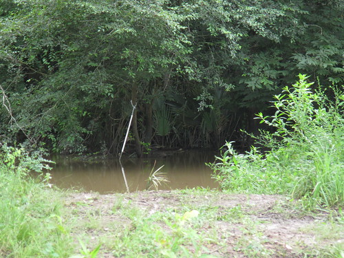
The bayou was just about lapping at the bottom of the bridge, and the current was quite high for the bayou — probably just a hair over two miles an hour. Well, so much for the difficult entry. The water was perhaps a foot down from the top of the bank. Of course, the ease of the entry and exit would be more than compensated for by the effort of paddling upstream against that current on the return leg. We’ve been doing this long enough to know that you just go with what the bayou gives you, and our guests were right there with us.

The current made easy going for the first two miles downstream. We were pointing out mile markers and former blockages along the way. Then around the infamous formerly 65-yards-epic blockage, the bayou was over the banks and the current dropped off (as it does). We kept going, just enjoying the bayou, as we entered the Car Wash — at high water levels, the branches that are normally well overhead turn the section of bayou between mile marker 2 and just downstream of mile marker 1 into a weaving, branch-dodging run. Everyone was a good sport about it, and only once did we have to pause to make quick work of one small spot blocked completely by branches.
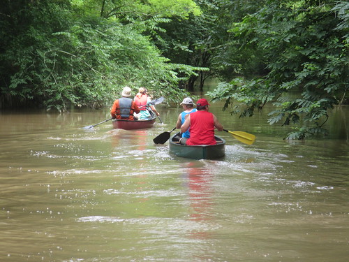
With good paddlers and a current behind us for the first half of the trip, it was less than an hour and half to get all the way to Bayou Manchac. From there, it was either call for a shuttle and press on to Airline Highway Park or Manchac Park or else turn around and paddle the four miles back upstream to Highland Road Park, which wasn’t much farther. The choice was made to return the way we came, and so back up the bayou we went.

Along the way back, we got another great view of the shining example of how to build by the bayou. So much better than the Not-So-Great Wall of Fountain or a soon-to-be-gone grass lawn. With the current, the last two miles were slower going, but we all made it back in excellent condition (as was the bayou). When we made it back to the park, we looked at some potential launch options that may be possible in the future (hopefully the nearer end of the future), and then everything was packed up and another trip complete.
It was nice to get to show off the bayou to more people, and we were rather pleased by the minimal problems the latest high water had brought. (There was but one small catch, not difficult to paddle through, and it mostly fell apart under the traffic of three passing canoes.) While paddling against the current was a bit of work, all in all, it felt as if we practically took the day off. (My elbow hasn’t felt this good in months.) We even ended up scrubbing plans to grab the barrels and big stuff out of the bayou since the low bridge on the upstream side and the Car Wash heading downstream side were in the way. I suppose that means we’re all ready to go get them next time, eh? We can hardly wait.


What’s the verdict? Is BREC going to build a launch? What about the bridge? Is it ever going away?